 SatTrackCamBlog")
Generate New Template
Digging through the web I found a sat track cam blog with what I believe is new info for this group.
most important here is military confirmation that satellites where used to detect mod air explosions.
A few things covered:
According to the news reports, the SBIRS network WAS USED to look for any traces of a mid-air explosion of flight MH370. They claim nothing was observed. Defense specialists quoted in the news article claim that the SBIRS system is capable to detect such mid-air aircraft explosions. News report
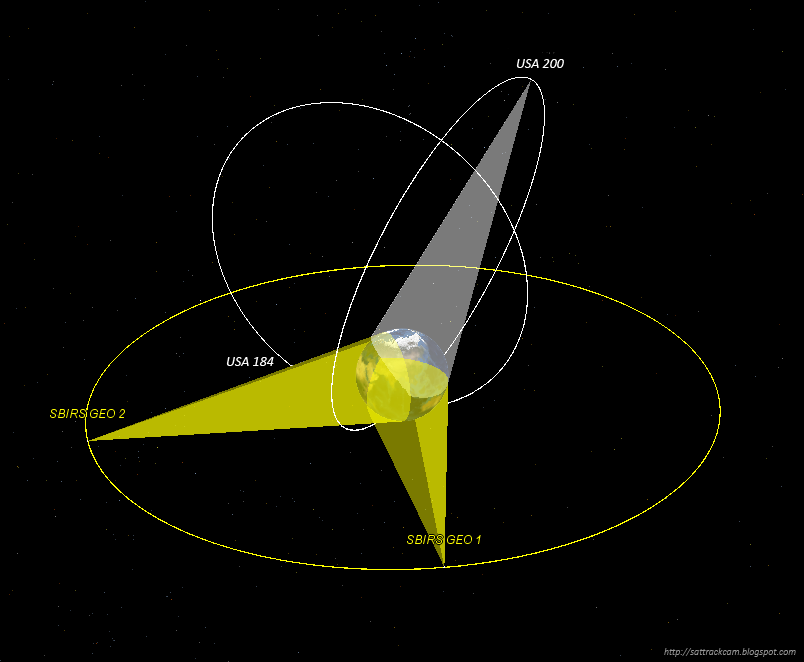
SBIRS currently consists of four satellites (see image above): two satellites in Geostationary orbit (SBIRS Geo 1 and SBIRS Geo 2, 2011-019A and 2013-011A), and two satellites in a Highly Elliptical Orbit (USA 184 and USA 200, 2006-027A and 2008-010A) with a SBIRS package piggybacked on to them.
Of these, two satellites had a view of the area where flight MH370 disappeared at that moment it disappeared: the geostationary SBIRS Geo 1 and the SBIRS HEO USA 200.
submitted by /u/balitiger13
[link] [comments]